Mostrar el registro sencillo del ítem
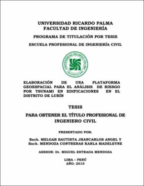
Elaboración de una plataforma geoespacial para el análisis de riesgo por tsunami en edificaciones en el Distrito de Lurín
| dc.contributor.advisor | Estrada Mendoza, Miguel Luis | |
| dc.contributor.author | Melgar Bautista, Jhancarlos Angel | |
| dc.contributor.author | Mendoza Contreras, Karla Madeleyne | |
| dc.date.accessioned | 2019-08-20T19:53:25Z | |
| dc.date.available | 2019-08-20T19:53:25Z | |
| dc.date.issued | 2015 | |
| dc.identifier.uri | https://hdl.handle.net/20.500.14138/2226 | |
| dc.description.abstract | La presente tesis consiste en el análisis de riesgo ante un Tsunami en edificaciones del distrito de Lurín, el cual es vulnerable por estar ubicado próximo al mar. El desarrollo parte considerando tres escenarios sísmicos de gran magnitud (Mw= 8.0, Mw=8.5 y Mw=8.7) en el Distrito de Lurín, tomando como punto de partida métodos empíricos para hallar los parámetros de estimación de tsunami como la altura máxima de la ola, tiempo de llegada de la primera ola a la costa y la altura de inundación que esta genera. Con los parámetros calculados del tsunami y la información obtenida de entidades nacionales como el Instituto geográfico nacional (IGN), Instituto Nacional de estadística e informática (INEI) y la Municipalidad de Lurín, se elabora la plataforma Geoespacial (SIG), con la introducción y el almacenamiento de estos datos se procederá con análisis y la presentación en forma de tablas de atributos y mapas temáticos, que nos permiten identificar las zonas potencialmente vulnerables, determinar las zonas inundadas, los lotes afectados, la cantidad de personas damnificadas y las pérdidas económicas que se generan, es decir, nos permite analizar el riesgo y vulnerabilidad de las edificaciones, por consiguiente permitirán desarrollar planes de prevención. The folowing thesis is about The analysis of risk in front of a tsunami on buildings in Lurin district. This study area is near to the sea and It is seated in a surface whose topography is not hilly, that is the reason why this district has a constant danger of being hitted by a tsunami. The developement of this thesis has considered three seismic scenarios of great magnitude (Mw= 8.0, Mw=8.5 y Mw=8.7) in Lurin District, having as a starting point empirical methods to find tsunami parameters which are máximum wave height, arrival time of the first wave to the shore and run up. Using tsunami parameters and information obtained from national entities such National geographic Institute (IGN), National Institute of Statistics and Informatics (INEI) and the Municipality of Lurin, the geospacial plataform will be elaborated and as result it has attribute tables and thematic maps to detect potentially vulnerable areas, determine the flooded areas, the affected lots, the number of people affected and economic losses, in other words, this allows the analysis of risk on buildings, Therefore to stablish prevention plans to minimize economic and human losses. | es_ES |
| dc.description.uri | Tesis | es_ES |
| dc.format | application/pdf | es_ES |
| dc.language.iso | spa | es_ES |
| dc.publisher | Universidad Ricardo Palma | es_ES |
| dc.rights | info:eu-repo/semantics/openAccess | es_ES |
| dc.rights.uri | https://creativecommons.org/licenses/by-nc/4.0/ | es_ES |
| dc.source | Universidad Ricardo Palma | es_ES |
| dc.source | Repositorio institucional - URP | es_ES |
| dc.subject | Tsunami | es_ES |
| dc.subject | Análisis de riesgo | es_ES |
| dc.subject | Nivel de daño | es_ES |
| dc.subject | Pérdida humana y económica | es_ES |
| dc.subject | Plan de evacuación | es_ES |
| dc.subject | Analysis of risk | es_ES |
| dc.subject | Damage level | es_ES |
| dc.subject | Human and economic losses | es_ES |
| dc.subject | Evacution plans | es_ES |
| dc.title | Elaboración de una plataforma geoespacial para el análisis de riesgo por tsunami en edificaciones en el Distrito de Lurín | es_ES |
| dc.type | info:eu-repo/semantics/bachelorThesis | es_ES |
| thesis.degree.discipline | Ingeniería Civil | es_ES |
| thesis.degree.grantor | Universidad Ricardo Palma. Facultad de Ingeniería | es_ES |
| thesis.degree.level | Título Profesional | es_ES |
| thesis.degree.program | Programa de Titulación por Tesis | es_ES |
| thesis.degree.name | Ingeniero Civil | es_ES |
| dc.publisher.country | PE |
Ficheros en el ítem
Este ítem aparece en la(s) siguiente(s) colección(ones)
-
Ingeniería Civil [943]


